
California Guide to Big Pine Lakes, Channel Islands, & More
By Cap Puckhaber, Reno, Nevada
I’ll never forget the first time I saw Big Pine Lakes. I had seen the photos online, but I genuinely thought they were enhanced or completely fake. That surreal, aquamarine water… it’s just not something you see in real life. That hike absolutely hooked me. It sent me down a rabbit hole of exploring every corner of California, from the most famous spots to the brand new ones. I’ve camped under massive redwoods, hiked on remote islands, and explored deserts that feel like another planet. Here some of my tops picks and my California Guide to hiking, camping, and backpacking some of my favorite spots.
California is a camper’s paradise. It offers these incredibly diverse landscapes. You can go from towering redwoods to scenic coastlines and vast deserts, all in one state. I’ve gathered all my notes from my most memorable trips. This includes my favorite campgrounds, that stunning Sierra hike, a rugged island escape, and the scoop on new protected lands. I’m consolidating all my trip details, first-person accounts, and advice here to help you plan your own adventure.
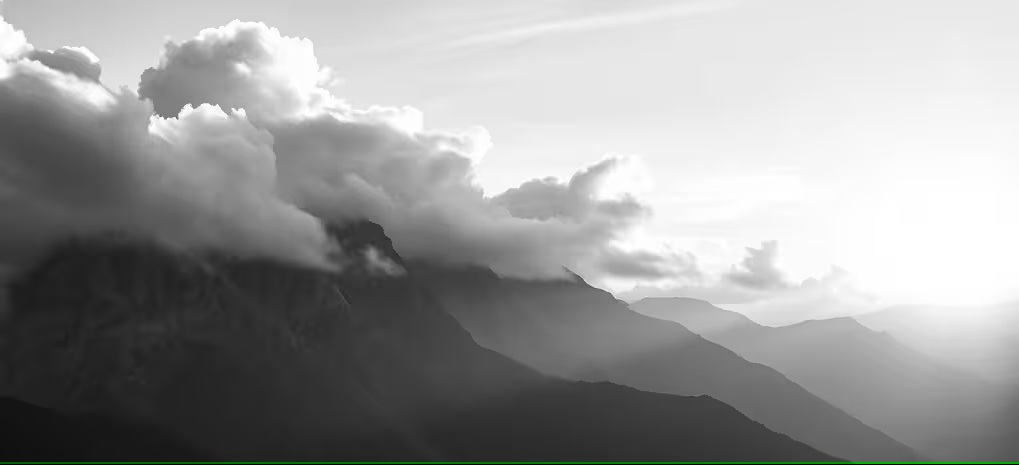
The Sierra Nevada’s Crown Jewel: Hiking Big Pine Lakes
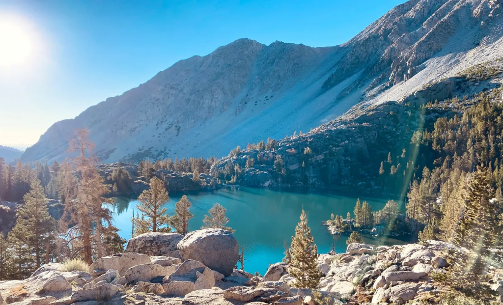
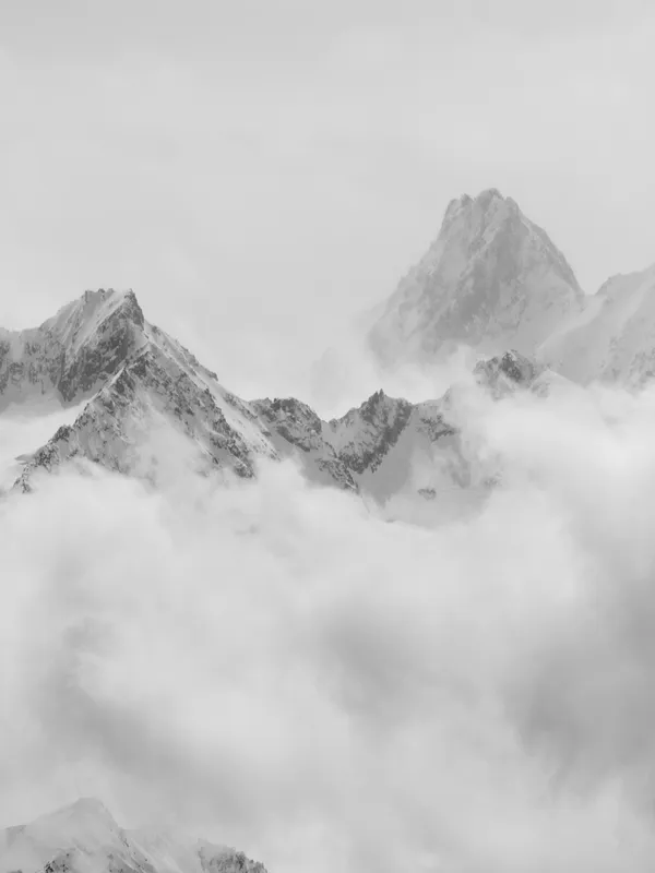
Tucked deep in California’s Eastern Sierra, Big Pine Lakes is one of those places that doesn’t just look like a dream—it feels like one too. Between the aquamarine glacial waters, the towering granite peaks, and the quiet stillness of the forest, it’s the kind of hike that carves itself into your memory. I’ve been on this trail multiple times. It’s now my top recommendation for anyone road-tripping down Highway 395 or coming from LA.
My First Glimpse of That Turquoise Water
You’ve probably seen the pictures of that unreal teal-blue lake. I’m telling you, it’s not color-enhanced. That’s First Lake, and it gets its stunning color from glacial silt suspended in the meltwater. This water flows down from the Palisade Glacier, which is the largest glacier in the Sierra. That first lake is just the start. The Big Pine Creek North Fork Trail actually passes seven different lakes. Each one feels a little more breathtaking than the last as you climb higher into the basin.
How to Get to the Big Pine Lakes Trailhead
Finding the trailhead is pretty straightforward, even though it feels remote. Big Pine Lakes sits in the Inyo National Forest, just west of the tiny town of Big Pine right on Highway 395. Once you reach the town, you’ll turn west onto Glacier Lodge Road. You just follow that road for about 11 miles. It ends right at the Big Pine Lakes trailhead, where there’s a large parking lot and some pit toilets. The road is paved the whole way, but it definitely gets windy and steep near the end.
What to Expect on the Big Pine Creek North Fork Trail
The full Big Pine Lakes trail is about 15 miles round trip if you go all the way to Seventh Lake. Most day hikers I see on the trail aim for First through Third Lake. That makes for a solid, satisfying 9-mile round trip. The trail climbs steadily the entire time. You’ll gain about 2,300 feet in elevation, topping out at just under 10,000 feet. The landscape shifts constantly as you climb. Early on, you’ll pass groves of Jeffrey pine and aspens along the creek. As you get higher, the trees thin out, the views open up, and you’ll pass old stone cabins before you hit that first stunning lake.
Let’s Talk Permits for Big Pine Lakes
This is the part that trips most people up. For day hikes, you don’t need a permit. You can just show up, park at the trailhead, and hit the trail. But for Big Pine Lakes backpacking, a wilderness permit is absolutely required. During the peak season, which runs from May to October, these permits are highly competitive. You have to reserve your permit in advance through Recreation.gov. You’ll search for the “Big Pine Creek North Fork Trail” quota. They open six months in advance and book up almost instantly. If you miss out, a few walk-up permits are sometimes available at the Eastern Sierra Visitor Center in Lone Pine, but you have to get there very early.
A Quick Packing List for Your Sierra Hike
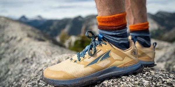
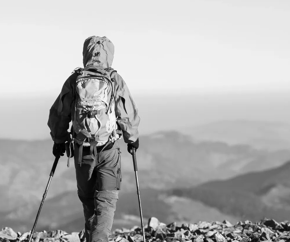
Even a day hike here is serious business. The high elevation, sun exposure, and length can catch people off guard. I always bring at least 2 to 3 liters of water for a day hike. I also carry a water filter like a Sawyer Squeeze just in case I need to refill from a stream. Sun protection is critical. The sun at 9,000+ feet is no joke. You’ll want a hat, sunglasses, and high-SPF sunscreen. Layers are also key, as weather can shift fast in the Sierra. And please, wear sturdy hiking shoes. The trail has some very rocky and uneven stretches.
My Biggest Mistake: Don’t Underestimate the Elevation
Here’s my “what not to do” advice. The first time I did this hike, I drove straight from sea level and tried to rush up the trail. That was a big mistake. The trailhead is already high, and you’re climbing to nearly 10,000 feet. I got a pounding headache and felt nauseous, classic signs of altitude sickness. Now, I always try to acclimate for at least a day in Bishop or Big Pine before tackling the climb. Take your time on the trail, drink tons of water, and don’t try to be a hero. It’s much more enjoyable when you’re not feeling sick.
Island Hopping off the Coast: Exploring Channel Islands National Park
If you’re looking for an unforgettable California adventure, you don’t have to travel far. Nestled right off the Ventura County coast lies one of the most pristine and unique places in the United States—Channel Islands National Park. I’ve spent time there as a naturalist and guide, and I can promise you this park offers an experience like no other. It’s known for its dramatic landscapes, incredible wildlife, and rich history.
The Boat Ride is Half the Adventure
Your adventure begins with a boat ride from Ventura Harbor to one of the five islands in the park. The boat ride itself, usually with the park concessionaire Island Packers, is a stunning experience. As you cruise out from the harbor, you’ll be greeted by panoramic views of the Pacific Ocean. You have a great chance to spot sea lions, massive pods of common dolphins, and maybe even whales along the way. I always tell people to keep their eyes peeled, as the crossing is a world-class wildlife-watching trip.
My Favorite Hikes on Santa Cruz and Anacapa
Once you arrive, you’ll have access to some of the most spectacular hiking trails in the country. Each island offers unique landscapes. Anacapa Island is the smallest and is known for its striking sea cliffs. The most popular trail is the short hike to the Anacapa Island Lighthouse. It offers a fantastic vantage point of the island’s rugged terrain. If you’re looking for a more challenging hike, Santa Cruz Island offers several trails. The Smuggler’s Cove Trail is a moderate hike that leads to a beautiful, secluded beach. The more challenging Montanon Ridge Trail rewards hikers with sweeping views of the island.
The Wildlife You Can’t See Anywhere Else
Channel Islands National Park is a wildlife lover’s paradise. The islands are home to unique species of plants and animals, many of which can’t be found anywhere else in the world. A local naturalist guide can help you spot the hidden gems. My favorite is the Channel Island fox. It’s a tiny, cat-sized fox that is found nowhere else on Earth. They are often curious and can be seen trotting around the campground on Santa Cruz. Be sure to also check out the Channel Islands Marine Sanctuary. You can snorkel or kayak to see rich kelp forests, sea caves, and abundant marine life.
Why I Recommend a Naturalist Guide
I might be a little biased since I’ve guided here, but working with a local guide is the best way to truly experience the park. Guides offer deep knowledge of the park’s ecosystems, history, and wildlife. This ensures you don’t miss any of the hidden gems. By choosing a guided experience, you’ll also get insider tips on the best trails. You’ll learn how to spot rare animals and where to find the best panoramic views. It just adds a layer of depth to the trip that’s hard to get on your own.
My Go-To Guide for California’s Top Public Campgrounds
As I said, California is a camper’s paradise. I’ve camped all over this state, from the high mountains to the low deserts. I’m consolidating my list of the top 10 public campgrounds. These are selected based on my personal experiences with their location, weather, accessibility, views, and activities.
Yosemite’s Best: Why I Always Choose North Pines
I’ve camped in Yosemite Valley more times than I can count, and North Pines is always my first choice when I can get a site. It’s right in the heart of the valley. You’re surrounded by towering granite walls and massive pines that make every direction look like a postcard. You can walk to the Merced River in minutes. You can also hit iconic hikes like Vernal Fall and Nevada Fall without ever needing to move your car. The campsites are flat and roomy. You absolutely need a reservation on Recreation.gov. They are one of the most competitive reservations in the entire state.
Coastal Camping at Moro Campground (Crystal Cove)
Moro Campground is my go-to when I want to camp by the ocean without leaving Southern California. The views are phenomenal. You’re perched on a bluff overlooking Crystal Cove, right between Newport Beach and Laguna Beach. I’ve rolled out of my tent at sunrise and watched the fog lift off the Pacific. The campground is right off Pacific Coast Highway and has about 60 sites. You’re not camping down on the sand, but there’s a short trail that leads straight to the beach and tidepools. Reservations are required year-round and are handled through ReserveCalifornia.
Sleeping Under Giants at Jedediah Smith
Camping among the redwoods at Jedediah Smith is something every California camper should do at least once. The trees here are ancient and enormous. You feel like a tiny dot under a living cathedral. I’ve stayed here in summer when everything is green, misty, and cool. The campground is just outside Crescent City, near the Oregon border. The campsites sit right under towering redwoods, with a few close to the beautiful Smith River. You can kayak or fish from the riverbank when the water is calm.
Redwoods and Rivers: Pfeiffer Big Sur State Park
Big Sur has a way of pulling me back every year, and Pfeiffer Big Sur State Park is my favorite campground there. You’re camping in a canyon filled with redwoods. The Big Sur River runs right through the camp. The sound of the water and the smell of the forest create a magical atmosphere. The sites are large and shaded. The trails to Pfeiffer Falls and Valley View are right outside the campground, so hiking is easy to fit in. These sites also book up months ahead on ReserveCalifornia.
Lakeside Views at D.L. Bliss in Lake Tahoe
Lake Tahoe is my go-to when I want mountain lakes and big adventures. D.L. Bliss State Park sits on Tahoe’s west shore. It offers that crystal-clear water and stunning granite cliffs. It feels a bit quieter than some other Tahoe campgrounds, which I really appreciate. The Rubicon Trail, a favorite hike of mine, starts right at the campground. It’s a rugged trail with amazing views of the turquoise water. Reservations are required here and are very popular in summer.
Desert Camping Among Boulders at Jumbo Rocks
Jumbo Rocks in Joshua Tree National Park is one of the most unique camping spots I’ve ever experienced. The massive granite boulders surround you. They create natural walls and places to climb right from your site. The desert sunsets here turn the rocks a deep red. The night sky is just packed with stars. Many sites are first-come, first-served, though some can be reserved now. You must come prepared with all your own water, as none is available there.
Giant Trees and River Sounds at Lodgepole
Sequoia’s Lodgepole Campground has become a staple for me when exploring the giant trees. It’s easy to get to from the park entrance on Highway 198. The sites are large and shaded by pines, with a river running nearby. I’ve enjoyed hearing the river at night and spotting deer right from my campsite. Reservations are a must here, especially in summer. You can book on Recreation.gov.
The Backpacker’s Dream: Wildcat Campground
Wildcat is a backpacker’s dream. It’s not a drive-up spot. You hike in about 5.5 miles from the Palomarin Trailhead in Point Reyes National Seashore. You have to carry all your gear through forest and along coastal bluffs. Once there, you camp on a grassy plateau overlooking the ocean. The sites are primitive, but the views make up for the lack of amenities. I’ve seen whales from camp and watched the fog roll in across the cliffs.
Desert Winter Escapes at Furnace Creek
Death Valley’s Furnace Creek Campground is where I escape the cold months. You can drive in from Highway 190. The campground has large, open sites. Some areas even have full hookups for RVs. It’s surrounded by vast desert landscapes and mountain backdrops. I love waking up early to explore nearby sand dunes and canyons before the day heats up.
Volcanic Vistas at Manzanita Lake
Manzanita Lake in Lassen Volcanic National Park is a peaceful spot. I visit when I want to combine alpine lake views with volcanic landscapes. The campground sits right next to the lake. It offers stunning views of Lassen Peak. I’ve kayaked on the lake and hiked nearby volcanic trails, all within walking distance from my tent. Reservations are required and can fill fast during the short summer season.
Exploring the Newest Protected Lands: Our New National Monuments
As much as I love my old favorites, I’m always excited about new places to explore. California and the U.S. continue to protect and celebrate stunning natural landscapes. Two new national monuments in California—Chuckwalla and Sáttítla—are set to join the roster. This is fantastic news for hikers, backpackers, and anyone who wants to connect with nature. I’ve also been tracking other new designations across the country that are worth a look.
California’s New Gem: Chuckwalla National Monument
Located in the southeastern part of California, Chuckwalla National Monument spans over 1,000 square miles of desert terrain. This expansive area is known for its striking landscapes. You’ll find rugged mountains, desert valleys, and volcanic rock formations. It is named after the chuckwalla lizard, a species native to the region. This monument was designated in 2024. The designation helps ensure the region remains free from large-scale development, preserving its beauty and wildlife habitats.
What to Do in Chuckwalla
Chuckwalla National Monument is a paradise for outdoor adventurers who love the desert. Hiking and backpacking are the primary activities in this area. You’ll find a range of trails suited to different levels. The desert terrain offers unique hiking opportunities. Wildlife watching is also a highlight. The monument is home to diverse species, including the chuckwalla lizard, desert tortoises, and bighorn sheep. Visitors must be prepared for extreme heat during summer months. Always bring plenty of water.
California’s Other New Treasure: Sáttítla National Monument
Sáttítla National Monument is located in the northeastern region of California. It covers an area of more than 700,000 acres. This monument is celebrated for its natural beauty and its deep cultural significance to the indigenous tribes in the area. Sáttítla, which means “Place of Spirit” in the local Native American language, is known for its lush forests and pristine rivers. Designated in 2024, Sáttítla’s creation provides permanent protection for the land.
Hiking and Exploring Sáttítla
For hikers and backpackers, Sáttítla National Monument offers a range of outdoor activities in its rugged terrain. The area features a network of trails. These trails traverse dense forests, remote valleys, and pristine river systems. Trails vary in difficulty, making the monument accessible to casual hikers and experienced backpackers. Camping and fishing are also popular activities in Sáttítla. Wildlife enthusiasts will be able to spot a variety of species, including black bears and mountain lions.
A Look at Other New Monuments: Castner Range, Texas
While my heart is in California, I get excited about new monuments everywhere. The Castner Range National Monument in El Paso, Texas, is a remarkable new addition. This area, encompassing over 7,000 acres, is a former military testing range. It was established as a national monument in 2023. This decision protects the natural landscape. It also honors the rich cultural history of the region, including numerous rock art sites and ancient Native American dwellings.
Heading East: New River Gorge, West Virginia
The New River Gorge, located in southern West Virginia, is another stunning example. It was recognized for its striking landscape and was designated as a national monument in 2020. The New River Gorge has long been a beloved spot for outdoor adventurers. This area is a paradise for hikers, climbers, and outdoor lovers. It has over 50 miles of trails. The famous Endless Wall Trail offers some of the best views of the gorge. It’s also renowned for world-class white-water rafting.
Common Questions I Get About California Hiking & Camping
I get a lot of DMs and emails with questions about these trips. It makes sense. Planning an adventure in California can feel overwhelming because the state is so massive and diverse. Here are my answers to the most common questions I hear.
What’s the best time of year to visit?
This totally depends on where you’re going. For the high Sierra, like Big Pine Lakes, Yosemite, or Sequoia, the season is very short. You’re looking at late June through early October. Any earlier, and you’ll hit too much snow. For the deserts, like Joshua Tree or Death Valley, you want the exact opposite. I only go in winter or the shoulder seasons of spring and fall. Summer is dangerously hot. The coast, like Big Sur or Crystal Cove, is pretty great year-round. I personally prefer spring for wildflowers or fall for clearer skies and fewer crowds.
How do I handle reservations for popular parks?
You have to be persistent. It’s like trying to get concert tickets for a huge band. For national parks like Yosemite and Sequoia, you’ll use Recreation.gov. For state parks like Pfeiffer Big Sur and Crystal Cove, you use ReserveCalifornia. Most reservations open six months in advance to the day. I mark my calendar, set an alarm, and am logged in right when the window opens. For walk-up permits, like the few available for Big Pine Lakes, you have to show up at the Eastern Sierra Visitor Center in Lone Pine before they even open and hope for the best.
What are the essentials I should never hike without?
I’m a big believer in the “Ten Essentials” even on a simple day hike. You can find a great list of them on REI’s website. My personal non-negotiables that I never leave the car without are: more water than I think I’ll need, a water filter, a headlamp, and a small first-aid kit. I also always download my map offline on an app like AllTrails. Service is spotty or non-existent in almost all of these beautiful places. You can’t rely on your phone’s cell signal for navigation.
My Final Thoughts on Exploring the Golden State
Writing all this down just makes me want to pack my bags and hit the road again. From the surreal turquoise water of the Sierra to the ancient, misty redwoods and the remote Channel Islands, California’s outdoor scene is just unmatched. It’s a place that holds so much. You can find the challenge of a high-elevation backpacking trail. You can also find the simple peace of a car campground by a river. I hope my experiences, tips, and personal accounts help you plan your own epic adventure.
Let Me Know Your Favorites
I’ve shared my top spots and my personal stories from the trail. But I know I’ve only scratched the surface. I’m always looking for new trails to hike and new campgrounds to explore. What’s your favorite California hike or campground? Leave a comment below. I’d love to add it to my list for my next trip. Happy trails.
About the author
Cap Puckhaber is a marketing strategist, finance writer, and outdoor enthusiast. He writes across CapPuckhaber.com, TheHikingAdventures.com, SimpleFinanceBlog.com, and BlackDiamondMarketingSolutions.com. Follow him for honest, real-world advice backed by 20+ years of experience.
My Real-World Hiker’s Guide to Yosemite National Park
John Muir Wilderness Guide for Beginners
Join our Mailing List
Sign up with us now and be the first one to know about our exclusive offers and product updates.
By submitting your information, you`re giving us permission to email you. You may unsubscribe at any time.
Follow Cap Puckhaber on Social Media

About the Author: Cap Puckhaber
Backpacker, Marketer, Investor, Blogger, Husband, Dog-Dad, Golfer, Snowboarder
Cap Puckhaber is a marketing strategist, finance writer, and outdoor enthusiast from Reno, Nevada. He writes across CapPuckhaber.com, TheHikingAdventures.com, SimpleFinanceBlog.com, and BlackDiamondMarketingSolutions.com.
Follow him for honest, real-world advice backed by 20+ years of experience.