
My Tips for Hiking the Sawtooth Wilderness
By Cap Puckhaber, Reno, Nevada
I am Cap Puckhaber, and I have spent the better part of two decades navigating the most rugged corners of the American West. My professional life in marketing and finance requires a high level of calculated risk. I apply that same analytical rigor to every mile I trek in the Sawtooth Wilderness of Idaho. This jagged mountain range offers nearly 350 miles of trails and hundreds of alpine lakes that will leave you breathless. I recently spent a full summer living and working in Stanley to truly understand the rhythm of this landscape. I want to share the hard lessons I learned so you can experience this high-altitude paradise safely and successfully.
The Raw Appeal of the Sawtooth Loop
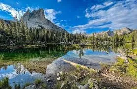
The Sawtooth Wilderness Loop is a premier backcountry destination that showcases the very best of the National Recreation Area. This 25-mile trek takes you deep into a world of granite spires and meadows that feel untouched by time. I find that the sheer verticality of these peaks creates a dramatic backdrop that rival any range in the world. The trail constantly rewards your physical effort with views that look like they belong on a postcard. You will climb through dense forests before emerging onto exposed ridges where the wind carries the scent of ancient pine.
Experienced backpackers flock to this loop because it offers a true sense of immersion. You are not just walking through the woods; you are entering a complex and fragile ecosystem. The region is famous for its jagged profiles that resemble the teeth of a giant saw. I have spent countless nights at high camp watching the light fade over these impressive stone towers. This is a place where self-sufficiency is a mandatory requirement for every person in your group. You must be prepared to handle everything the mountains throw at you without any outside help.
Navigating the National Recreation Area
The Sawtooth Wilderness sits within the massive Sawtooth National Recreation Area which covers over 750,000 acres. The U.S. Forest Service manages these lands to balance recreation with the preservation of natural resources. You will find that cell service disappears the moment you drive past the town limits of Stanley. This lack of connectivity means your planning must be flawless before you leave the trailhead. I always tell people that their primary safety tool is the information they carry in their heads.
The remote nature of the backcountry means you are responsible for your own rescue in an emergency. It can take hours or even days for help to reach the most distant sections of the wilderness loop. I carry a satellite messenger to ensure I can contact the authorities if a situation turns dire. However, you should never rely solely on a electronic device to save your life. You must possess the skills to navigate and provide basic first aid in a wilderness setting. The SNRA is a place of incredible beauty but it does not forgive those who are unprepared.
Starting at Redfish Lake
Most adventures in this region begin at the iconic Redfish Lake Trailhead. This five-mile long body of water sits at the base of the mountains and serves as a natural gateway to the high country. I often use the lodge and the marina as a final staging area to double check my gear. You can find basic supplies and a friendly atmosphere before you head into the silence of the woods. The views from the shore of the lake are enough to inspire even the most casual hiker.
The parking lot at Redfish Lake fills up extremely quickly during the peak summer months. I recommend arriving at the trailhead before 7 a.m. to secure a spot for your vehicle. If you show up late on a Saturday, you might find yourself walking an extra mile just to reach the start of the path. Many hikers choose to take the boat shuttle across the lake to save several miles of trekking. This shuttle is a great way to jumpstart your trip and get deeper into the wilderness faster. It also provides a unique perspective of the mountains as you glide across the cold blue water.
The Magic of Alice and Toxaway Lakes
Many outdoor enthusiasts consider the Alice-Toxaway Loop to be the scenic crown jewel of the entire range. These two pristine lakes sit in dramatic glacial basins that are separated by a high mountain pass. The climb up to the pass is strenuous but the reward is a 360-degree view of the surrounding peaks. I find that the granite walls around Alice Lake create a natural amphitheater that is perfect for photography. The water is so clear that you can see the trout swimming deep below the surface.
I recommend spending at least two nights in this area to truly soak in the atmosphere. You can use one of the lakes as a base camp and explore the nearby ridges without a heavy pack. The transition from the lush greenery of the lower basin to the stark rock of the pass is beautiful. You will feel the temperature drop as you climb toward the jagged skyline. These lakes are the perfect place to test your alpine resilience and your love for the high country.
Mastering the New Moon Strategy
One of the most overlooked aspects of a Sawtooth trip is the quality of the night sky. The area around Stanley is a designated Dark Sky Reserve which means man-made light is strictly limited. I have seen the Milky Way in full force here and it is a sight that stays with you forever. To maximize this experience, I suggest planning your trip during a new moon. This ensures that the light from the moon does not wash out the brilliance of the stars.
Aside from a few remote spots in Utah, this is the best stargazing I have ever encountered. You can see thousands of stars reflecting in the still surface of the alpine lakes at night. It adds a whole new dimension to your backpacking experience when the sun goes down. I often stay up late just to watch the constellations move across the granite spires. It is a powerful reminder of how small we are in the grand scheme of the universe.
Realistic Water Management Tips
You do not need to stress about finding water while you are hiking in the Sawtooth Mountains. The trails frequently cross cold mountain streams and pass by dozens of alpine lakes. I typically carry a capacity for two liters of water but often only keep one liter full at a time. This helps keep my pack weight down while I am climbing the steep sections of the trail. I simply fill up my bottle whenever I cross a reliable water source along the path.
But you must purify every single drop of water you take from the backcountry. Giardia and other harmful bacteria are present in even the most pristine-looking mountain streams. I prefer using a lightweight squeeze filter because it is fast and easy to use on the go. You should also refer to your topographic map often to see where the next water source is located. There can be stretches of several miles without water when you are traversing high ridges. Staying hydrated is the best way to prevent altitude sickness and keep your energy levels high.
Safe Stream Crossing Protocol
With so many water sources, you will inevitably encounter several stream crossings on your hike. On my last trek to Alice Lake, I had to cross five different streams in just five miles. I always bring a pair of lightweight sandals to change into so my hiking boots stay dry. Wet boots can lead to painful blisters and can ruin your trip in a single afternoon. You should never attempt to cross a stream in your bare feet because the rocks are very slippery.
There are some critical rules for a safe stream crossing that every hiker must know. First, you should always unclip the hip belt on your backpack before you step into the water. If you fall, you need to be able to shed your pack quickly so it does not pull you under. Second, do not attempt to cross anything that is deeper than your waist or moving too fast. I test the speed of the water by throwing a small stick into the current. If the stick moves faster than I can walk, the water is too dangerous to cross.
Dealing with Aggressive Mountain Bugs
This might sound like a simple tip, but the bugs in the Sawtooths are more active than in many other ranges. I once tried to use an all-natural bug spray made of essential oils and it was a total failure. I was covered in bites before I finally gave in and used a spray with DEET. The mosquitoes here can bite right through thin base layers and even some types of leggings. You must prepare for the bugs with more intensity than you would in other backcountry areas.
I hate the feeling of chemicals on my skin when I cannot shower, but sometimes it is a necessity. A good alternative is to wear long sleeves and pants that have been treated with permethrin. I have also found that bug-repelling bracelets can provide a small amount of extra protection. You should try to find campsites that are away from standing water or boggy meadows where bugs thrive. A light breeze can also be your best friend when it comes to keeping the mosquitoes at bay.
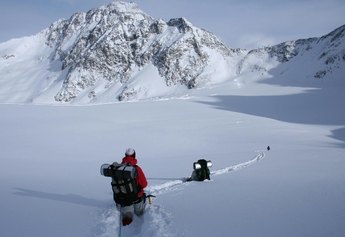
The Best Window for Summer Hiking
The Sawtooth Mountains stay covered in snow for a large portion of the year. If you want a pleasant and snow-free experience, you should plan your trip between July and mid-September. I have seen snow on the high passes even in the middle of a warm August afternoon. The summer crowds are manageable compared to what you will find in a major national park. You only have to hike a few miles past the trailhead to find the solitude you are looking for.
Early July is a beautiful time to visit because the wildflowers are in full bloom across the meadows. However, this is also when the stream crossings are at their highest and most dangerous levels. By late August, the water levels have dropped and the bugs have started to die off. This is my favorite time to be in the mountains because the air is crisp and the nights are cool. You should always check the latest trail reports to see if the high passes are clear of snow before you go.
Cold Water Shock Awareness
One of my favorite activities is jumping into a cold alpine lake after a long and sweaty day of hiking. It is an incredible way to refresh your body and your mind after miles of effort. But you must be aware of a dangerous condition called cold water shock. This is an involuntary physical reaction that causes you to gasp when you are suddenly submerged in icy water. If you gasp while your head is underwater, you can pull water into your lungs and drown.
I always ease my way into the water slowly to let my body adjust to the extreme temperature. Never jump into deep water where your feet cannot touch the bottom until you know how you will react. I have felt the “gasp reflex” myself and it is a very scary sensation if you are not prepared for it. Enjoy the water but do it with a high level of respect for the power of the cold. Safety should always be your primary concern when you are miles away from medical help.
Logistics of Food and Supplies
The town of Stanley is a very small community with a permanent population of only around 70 people. They have a small market with basic supplies, but the prices are very high and the options are limited. I highly recommend buying all your trail food and snacks well before you reach the Stanley area. You will save a lot of money and you will have a much better selection of high-energy meals. Planning your menu in advance ensures you have the right balance of proteins and carbohydrates.
I usually do my final grocery run in a larger city like Boise or Ketchum before heading north. This allows me to find specific items like electrolyte tablets and specialized backpacking meals. Once you are in Stanley, you can stop at the local bakery for a fresh treat before you hit the trail. But do not rely on the town for your primary survival food for a multi-day trip. A little bit of logistical planning in the city will make your life much easier in the mountains.
Seeking Out Lesser Known Lakes
While Alice Lake and Sawtooth Lake are incredibly beautiful, they are also the most crowded spots in the range. You will struggle to find a secluded campsite at these popular locations during the peak summer weekends. I suggest using the famous lakes as a place for a lunch break rather than a place to sleep. There are hundreds of other alpine lakes nearby that offer the same beauty with a fraction of the foot traffic. You can often find a private lakeside paradise just by hiking one or two miles further.
Pretty much every lake in the Sawtooth Wilderness is stunning and worthy of your time. You are not missing out on the “best” view by choosing a lake that is not famous on social media. I find that the sense of solitude is much higher when I am the only person camping at a high-altitude tarn. Exploring the map for these hidden gems is one of the most rewarding parts of the planning process. Do not be afraid to leave the most popular paths and find your own version of the wilderness.
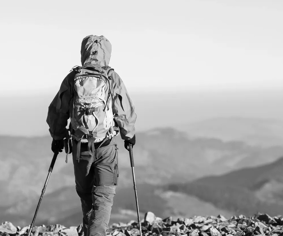
Essential Gear for Alpine Resilience
Packing the right gear is the difference between a great trip and a dangerous ordeal in the backcountry. The weather in the Sawtooths can change in an instant and you must be prepared for anything. I always pack a lightweight three-season tent and a sleeping bag that is rated to at least 20 degrees. Even in the middle of summer, the temperatures at high elevation can drop below freezing overnight. Your sleep system is your most important defense against the risk of hypothermia.
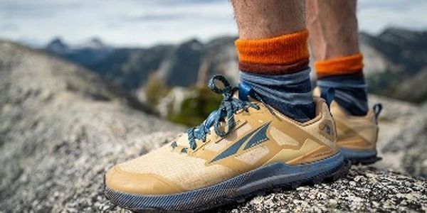
I also insist on wearing sturdy hiking boots that provide a high level of ankle support. The trails in this region are notoriously rocky and uneven which makes a twisted ankle a constant threat. I do not recommend wearing trail runners unless you have a very light pack and years of experience. A solid pair of boots will protect your feet from the sharp granite and give you more confidence on the steep descents. Your footwear is the foundation of your entire physical performance on the trail.
The Importance of Navigation Skills
You must carry a dedicated GPS device or a phone with offline maps, but you should always have a backup. Cell service is non-existent in the Sawtooth Wilderness and electronic batteries can fail in the cold. I always carry a high-quality physical map and a baseplate compass in a waterproof bag. Knowing how to read contour lines and orient your map to the landscape is a non-negotiable skill. I have seen many people get disoriented when a sudden fog rolls over the mountain passes.
I practice my navigation skills on every trip to ensure I can find my way even if my electronics die. Triangulation is a great technique to learn so you can find your exact position using distant peaks. You should also pay attention to the terrain and look back frequently to see what the trail looks like from the other direction. This helps you recognize the way home if you have to turn around due to weather or injury. Being a good navigator is one of the best ways to stay safe in the remote backcountry.
Mandatory Food Storage Rules
The U.S. Forest Service requires every backpacker in the Sawtooth Wilderness to use a certified bear-resistant container. This is a strict rule designed to protect the local black bear population from becoming habituated to human food. I use a hard-sided bear canister because it is easy to use and provides the best level of protection. Hanging a food bag is often difficult in the high country because the trees are either too small or non-existent. A canister ensures that your food stays safe and the bears stay wild.
Proper food storage also protects you from smaller critters like squirrels and marmots that can chew through a tent. I keep my canister at least 100 feet away from my sleeping area to minimize any nighttime visitors. Never keep food or scented items like toothpaste inside your tent at night. I have seen marmots destroy a expensive backpack just to get to a single wrapper of chewing gum. Being a responsible camper means keeping a clean site and respecting the rules of the wilderness.
Using Trekking Poles for Balance
I never step onto a Sawtooth trail without a pair of sturdy trekking poles. They are incredibly useful for navigating the steep and rocky sections of the loop, especially on the high passes. Poles help you maintain your balance and take a significant load off your knees during the long descents. They are also a vital safety tool for crossing streams and testing the stability of a rock path. I find that I am much more efficient and less tired at the end of the day when I use them.
You should adjust the length of your poles depending on whether you are going uphill or downhill. I shorten them for the climbs and lengthen them for the descents to get the most support. They can also be used as a probe to check the depth of a snow patch or the stability of a downed tree. Most modern poles are very lightweight and can be easily strapped to your pack when you do not need them. I consider them an essential piece of gear for anyone tackling the rugged terrain of Idaho.
My “Don’t” Example from the Trail
I want to share a mistake I made during an early trip to the Sawtooths to help you avoid the same fate. I once decided to push over a high pass late in the afternoon despite seeing dark clouds building on the horizon. I thought I could beat the storm, but I was caught on the exposed ridge when the lightning started. It was a terrifying experience as I scrambled down toward the treeline while the thunder shook the ground. I learned that afternoon that the mountains do not care about your schedule or your goals.
Now, I always try to be over the high passes and into a safe camp by early afternoon. Most mountain thunderstorms build up during the heat of the day and release their energy in the late afternoon. If you see clouds starting to tower and turn dark, it is time to find a safe place to wait it out. Do not let your desire to reach a specific lake cloud your judgment about the weather. I would rather spend a few hours in my tent than be a target for lightning on a high granite ridge.
The Leave No Trace Ethic
Protecting the fragile alpine environment of the Sawtooths is the responsibility of every person who visits. You must pack out every single piece of trash you bring into the wilderness, including food scraps and toilet paper. I carry a small plastic bag specifically for my waste and I never leave anything behind at a campsite. You should also camp on durable surfaces like rock or dirt to avoid damaging the mountain grasses and flowers. Following the seven principles of Leave No Trace ensures that the wilderness remains pristine for everyone.
I also avoid building campfires in the high country even if they are legally permitted. Fires can leave permanent scars on the ground and the local wood is often scarce at high elevations. A small backpacking stove is much more efficient for cooking and does not leave a mess behind. If you must have a fire, use an existing fire ring and make sure the ashes are cold to the touch before you leave. We are all stewards of these public lands and our actions have a direct impact on the health of the forest.
Final Thoughts on the Sawtooth Loop
The Sawtooth Wilderness offers a backcountry experience that is truly world-class. It is a place where you can find dramatic scenery, physical challenges, and a deep sense of peace. Whether you are seeking adventure or a way to disconnect from the modern world, these mountains deliver. I hope my tips help you plan a trip that is both safe and unforgettable in the heart of Idaho. The jagged peaks are waiting for you to come and explore their secrets.
I am Cap Puckhaber, and I am committed to helping you find your path in the great outdoors. You can find more gear reviews and trail inspiration through my work at TheHikingAdventures.com. Stay wild, stay prepared, and always respect the power of the mountains. I will see you out there among the granite spires and the blue alpine lakes. Thank you for taking the time to learn about one of my favorite places on the planet.
Frequently Asked Questions
Do I need a permit for a day hike in the Sawtooth Wilderness?
You do not need a specialized permit for a day hike, but you are often required to sign in at the trailhead kiosk. This helps the Forest Service track the number of visitors and can assist in a search and rescue operation if you go missing. For overnight trips, a free wilderness permit is mandatory and can also be found at the major trailheads. Always check the current rules at the ranger station before you begin your journey into the backcountry.
Can I bring my dog on the Sawtooth Wilderness Loop?
Dogs are allowed in the Sawtooth Wilderness but they must be kept on a leash during the peak summer months. This is to protect the local wildlife and to prevent conflicts with other hikers on the busy trails. You must also pack out all of your dog’s waste just like you would for your own trash. I recommend checking the pads of your dog’s feet frequently as the granite rock can be very abrasive. Make sure your pet is fit enough for the thousands of feet of elevation gain that the loop requires.
What is the best way to handle a bear encounter?
If you see a black bear, you should stay calm and give the animal plenty of space to move away. Most bears in the Sawtooths are shy and will avoid humans if they know you are there. I talk to the bear in a calm voice and slowly back away without turning my back on the animal. Never run from a bear as this can trigger their predatory instinct to chase you. You can find more expert advice on bear safety through the resources at Bloomberg.
Are there any specific fire restrictions I should know about?
Fire restrictions are very common in the Sawtooths during the dry summer months to prevent wildfires. The Forest Service often bans all campfires above a certain elevation or during times of high fire danger. I always check the latest alerts at the National Interagency Fire Center before I leave for a trip. Using a portable gas stove is usually allowed even when campfires are prohibited. Being fire-wise is a critical part of being a responsible outdoor enthusiast.
How do I get to the town of Stanley, Idaho?
The most common way to reach Stanley is by driving north from Boise or Ketchum along the scenic Highway 75. The drive takes about three hours from Boise and offers some of the best mountain views in the state. You should make sure your vehicle has a full tank of gas as services are limited along the remote sections of the road. You can find more travel tips and economic data for the region through the guides at Business Insider. Planning your route in advance will ensure a smooth start to your mountain adventure.
About the author
Cap Puckhaber is a marketing strategist, finance writer, and outdoor enthusiast. He writes across CapPuckhaber.com, TheHikingAdventures.com, SimpleFinanceBlog.com, and BlackDiamondMarketingSolutions.com. Follow him for honest, real-world advice backed by 20+ years of experience.
The Best 3-Day Backpacking Trips in the U.S.
Ultimate Guide to Backpacking Colorado
Join our Mailing List
Sign up with us now and be the first one to know about our exclusive offers and product updates.
By submitting your information, you`re giving us permission to email you. You may unsubscribe at any time.

Follow Cap Puckhaber on Social Media


About the Author: Cap Puckhaber
Backpacker, Marketer, Investor, Blogger, Husband, Dog-Dad, Golfer, Snowboarder
Cap Puckhaber is a marketing strategist, finance writer, and outdoor enthusiast from Reno, Nevada. He writes across CapPuckhaber.com, TheHikingAdventures.com, SimpleFinanceBlog.com, and BlackDiamondMarketingSolutions.com.
Follow him for honest, real-world advice backed by 20+ years of experience.