
What America’s dams mean for the trails, rivers, and wildlife we love
By Cap Puckhaber, Reno, Nevada
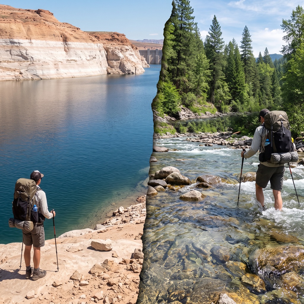
I stood on the shoreline of Lake Powell three summers ago. A bathtub ring of bleached sandstone rose sixty feet above the waterline. Just a week earlier I had waded a free stone creek in the North Cascades. The water was so clear I could count trout from twenty feet up the bank. Same rough season, same kind of country, two completely different rivers. One had been dammed into stillness. But the other still moved the way rivers are supposed to move.
That contrast is what got me paying attention to dams as a hiker. Dams decide whether the creek you’re counting on for camp water still runs in August. They decide whether the ford on your map is ankle deep or waist deep. Nobody posts that release schedule at the trailhead. So does the salmon run you drove six hours to photograph, and whether it actually shows up. Once you spend real time in the backcountry, dams stop being background infrastructure. So they become trail conditions.
This piece walks through why we build dams, and what a handful of major U.S. dams have done to the land around them. Then it gets practical, because all of that filters down into decisions you make with a map in your hand. I’ll share real numbers from the Elwha and Klamath restorations. I walked both of those recovering rivers myself. I’ll also flag the one crossing mistake I made below a dam release, so you don’t have to repeat it.
Why we build dams
Power, irrigation, and flood control
Every dam in this country exists because someone needed water to do a job it wasn’t doing on its own. Hydropower is the most visible reason. Hoover Dam alone can generate around four billion kilowatt-hours a year. That’s enough to serve a mix of homes and businesses across Nevada, Arizona, and California. But that output means the Colorado River downstream now runs on a power company’s schedule instead of a snowpack’s schedule.
Irrigation is the quieter reason, and it’s arguably the bigger one out west. Farmers in California’s Central Valley and Oregon’s Klamath Basin depend on stored reservoir water. Without it, a dry summer would wipe out their crops. But flood control matters too. Cities built on floodplains, from Sacramento to sections of the Ohio Valley, rely on upstream reservoirs. Those reservoirs catch spring runoff before it becomes a disaster downstream.
Municipal supply and recreation
Municipal water storage rounds out the list, and recreation trails not far behind it. Lake Mead and Lake Powell draw boaters by the millions every year. That economic activity keeps a lot of small towns afloat. I get why people love a reservoir vacation. But I notice almost nobody I hike with plans a backpacking trip around one. A reservoir doesn’t move, and moving water is most of what draws us into a canyon in the first place.
None of these five reasons exist alone. A dam built for flood control still generates power on the side. Likewise, a reservoir built for irrigation storage still attracts a marina. So when you’re standing at a trailhead wondering why a river behaves the way it does, remember this. The structure upstream is usually doing three or four jobs at once.
Five dams that show you the range of impact
Hoover Dam, Colorado River
Hoover Dam finished construction in the 1930s. It still ranks as one of the most recognizable engineering projects in American history. That structure has backed up Lake Mead, the largest reservoir by volume in the country, for nearly a century. From a hiker’s view, the payoff is a set of dramatic overlooks near Boulder City. The trade-off is a stretch of the lower Colorado that runs colder and clearer than it ever did naturally. Water released from deep in the reservoir skips the warm, silty character of a free river entirely.
Glen Canyon Dam, Lake Powell
Glen Canyon Dam still stirs the most argument among river people. Completed in the early 1960s, it drowned a network of side canyons. Early river runners called them some of the most beautiful terrain on the continent. Hikers can still reach a handful of slot canyons off Lake Powell by boat. But most of what Glen Canyon used to offer sits under two hundred feet of water. When the reservoir drops during drought, older side canyons briefly resurface. The exposed silt and stranded driftwood tell you exactly how much has been lost.
Klamath River dams, recently removed
Downstream in California and Oregon, the Klamath tells the opposite story. Four dams came down over a two-year span not long ago. Their names were JC Boyle, Copco 1, Copco 2, and Iron Gate. American Rivers calls it the largest dam removal project in U.S. history. The dams had blocked salmon and steelhead from roughly four hundred miles of habitat for close to a century.
I drove through the basin the following spring. Since then, I’ve walked a stretch of riverbank that had been underwater since before my grandparents were born. So grass was already coming back through the old sediment. It’s rare to watch a river reset itself in real time. This was that.
Elwha River dams, Olympic National Park
The Elwha removal came earlier, and it gave me my first real look at what dam removal does to a hiking trail. Crews took down the Elwha and Glines Canyon dams over roughly three years, finishing in the mid-2010s. That reopened more than seventy miles of salmon habitat inside Olympic National Park. I hiked the Elwha River Trail two years after the second dam came out. The change from pre-removal photos I’d seen was obvious, even to a first-time visitor. That old reservoir bed had become a wide gravel floodplain, threaded with new side channels. Rangers told me salmon had already returned to stretches that hadn’t seen a fish in a hundred years.
Grand Coulee Dam, Columbia River
Grand Coulee is the scale example. It’s the largest concrete structure in North America. It produces more electricity than any other power plant in the country, but it also permanently blocked salmon runs on the upper Columbia. Built without fish passage, it stands too tall for any ladder to solve. If you want to understand how completely a dam can rewrite a watershed’s biology, this is the extreme case. Everything downstream adapted around the missing fish. Upstream, though, they simply vanished.
How dams change the water you’re wading into
Temperature and sediment
Reservoirs stratify by temperature. Most dams release water from deep in that cold layer. That’s why a river below a big dam often runs noticeably colder than a free-flowing stretch nearby, even in July. Sediment gets trapped the same way.
A reservoir acts like a giant settling pond. So the water coming out the other side is clearer, but it’s starved of the sand and silt that naturally rebuild downstream banks. Below Glen Canyon Dam, this sediment starvation has been eroding Grand Canyon beaches for decades. That’s part of why the Bureau of Reclamation now runs periodic high-flow releases, just to redistribute what sand remains.
I rafted that stretch a few years back. Our guide pointed out camp beaches that had shrunk visibly within her own career on the river. She carried old survey photos to prove it. So comparing them against the current shoreline made a better argument than any statistic could.
Flow timing and water quality
Natural rivers peak with snowmelt and drop through late summer. Dammed rivers often flatten that curve, or invert it, releasing more water in winter for power demand and less in spring when fish expect it. Reservoirs also warm up in still water during summer. That can trigger algae blooms that wouldn’t happen in moving current. If you’ve ever pulled up to a reservoir campsite and found the shallows coated in green scum, that’s usually why.
How dams affect the wildlife you came to see
Fish migration
This is the impact hikers notice first, because it shows up as an absence. Salmon and steelhead need to move freely between ocean and headwater spawning grounds. Since a dam without fish passage simply stops that movement, whole runs can vanish within a generation. On the Klamath, annual salmon returns had fallen to a fraction of historic runs before removal began. Agencies recorded under 47,000 fall-run fish in one recent low year, against historic runs that once topped half a million. So reopening the river should rebuild those numbers over the coming decades. Nobody’s promising it happens fast.
Habitat fragmentation and the ripple upward
Blocked fish runs don’t stay a fish problem for long. Bears, eagles, and river otters that once fed on spawning salmon lose a major food source when a run disappears. So riparian plants that depend on nutrient-rich fish carcasses grow slower without them. Birds nesting along a reservoir shoreline face a different problem. Water levels can swing dozens of feet with drawdown schedules. Since nests are often built at what looked like a safe elevation, a single drawdown can wipe them out within a month. So the whole system is more connected than it looks from a single overlook.
Riparian vegetation takes a hit from both directions at once. Cottonwood and willow seedlings depend on spring floods to scour the banks and open bare ground for new growth. A dammed river that no longer floods on schedule lets older vegetation crowd out the young trees that would replace it. So a forest that looks healthy from a trail can actually be aging out with nothing behind it. I noticed this comparing the Elwha corridor before and after removal. The reservoir-era banks held a narrow, even-aged stand of trees. Only a decade on, the restored stretch already shows a much wider mix of ages pushing up through the old lakebed sediment.
How dams affect the parks and public land you’re hiking through
Elwha as a restoration case study
I already mentioned my hike on the Elwha. It’s worth returning to as the clearest example of what removal does for backcountry access. Trails that once dead-ended at a reservoir now continue along a genuinely wild river corridor. So campsites that sat on the edge of still water now overlook moving current and gravel bars full of new cottonwood growth. It’s the single best place in the country to see, in one afternoon, a river recovering from decades of impoundment.
Reservoirs inside and beside parks
Not every park story runs the same direction. Lake Powell sits just upstream of Glen Canyon National Recreation Area, a short drive from Grand Canyon National Park. So it draws boat traffic that a free river never would have. That traffic funds infrastructure and jobs. But it also means a huge stretch of what used to be hikeable slot canyon stays underwater. Only a hard drought drops the reservoir far enough to expose it again.
What drawdown means for trail access
Because reservoir levels aren’t fixed, trail access near a dam can change year to year in a way free-flowing river corridors don’t. A boat launch that worked in a wet year might sit two hundred yards from the waterline the next summer. Before I plan anything near a reservoir, I check the current pool elevation through the managing agency. That might be the Bureau of Reclamation, the Army Corps of Engineers, or the National Park Service. So the map in my hand is often out of date within a season.
How dams affect irrigation and the farms downstream
Water rights, briefly
Western water law runs on a system called prior appropriation. The oldest legal claim to a water source generally gets served first in a shortage. That system predates most environmental protections by a century. It’s a big part of why removing or reforming a dam takes so much negotiation. Farmers holding century-old water rights aren’t villains in this story. They’re operating inside a legal framework nobody designed with river ecology in mind.
Real trade-offs, real examples
The Klamath Basin shows the trade-off plainly. Farmers there depend on Klamath Project irrigation water to grow potatoes, alfalfa, and grain. That covers roughly two hundred thousand acres across the basin. Drought years have repeatedly pitted that need against minimum flows required to keep salmon alive downstream. There’s no version of this where everyone gets everything. The Klamath settlement that led to dam removal happened because tribes, farmers, and power companies negotiated water allocations. That negotiation ran alongside the physical removal itself, not instead of it.
I talked with a rancher near the basin during that same spring trip. He’d farmed the same land his grandfather worked. But he was clear that he didn’t see the dam removal as a loss for agriculture, the way outside coverage sometimes framed it. His allotment came from a separate water right, negotiated in the settlement.
He’d rather have certainty about his water supply than fight an endless legal battle every few years. That conversation changed how I talk about this topic on the trail. The fight over a dam is rarely farmers against fish. It’s usually about which century-old legal framework gets to decide who drinks first.
What this means for you on the trail
Checking conditions before you go
Before I plan a trip near a dammed or recently restored river, I check three things. I look up the managing agency’s current release schedule, since a dam can turn a wadeable creek into a dangerous flow within hours. Then I check recent trip reports for the specific trail, since guidebooks lag behind fast-changing restoration areas by years. And I call the local ranger station directly when a trip involves a ford, because a five-minute phone call has saved me from at least one bad decision.
The mistake I made below a dam release
Here’s the one I’d rather you not repeat. Years ago I crossed a creek below a small hydro dam in the early afternoon. I checked the depth and judged it fine at mid-shin. Then I came back through the same crossing four hours later, after the utility had opened a scheduled release. The same creek was running above my knee, with a current strong enough to nearly take my feet out from under me. I hadn’t thought to ask whether the flow was natural or managed. Now I always ask, every single time a dam sits anywhere upstream of a crossing I plan to use twice in one day.
It’s an easy mistake to make. Most guidebooks describe a crossing once, at whatever depth the author happened to find it. So they rarely mention that the depth might not hold for the rest of the day. A free-flowing creek fed purely by snowmelt is at least predictable within a season. But a dam-controlled creek can change on a utility’s schedule that has nothing to do with weather. That’s exactly the kind of detail that never makes it onto a trail map.
General water crossing safety
Whatever the source of the flow, the fundamentals from the National Park Service’s river crossing guidance hold up. Cross at the widest, straightest section rather than a narrow bend, since narrow water usually runs faster and deeper. Unbuckle your hip belt before entering the water, so a fall doesn’t trap you under a loaded pack. Use trekking poles for a third and fourth point of contact. Cross as a group when the water runs fast, with the strongest hiker positioned upstream to break current for everyone behind them.
Where to see recovery firsthand
If you want to watch a dam-removal story unfold with your own eyes, start with the Elwha River Trail inside Olympic National Park. It has day-hike sections and a longer backcountry route, both open now. The Klamath Basin will take longer to build formal trail infrastructure, since restoration work on the newly exposed riverbanks is still underway. But river access points along Highway 96 already offer a look at a river mid-recovery.
A note on sensitive restoration areas
Newly exposed riverbank is some of the most fragile ground you’ll walk on. Revegetation crews plant native species in careful patterns, to hold soil in place and outcompete invasives. Foot traffic off the established trail can undo months of that work in an afternoon. So stay on marked paths through any restoration zone, and pack out everything you bring in. Treat a recovering riverbank with the same care you’d give a fire-scarred forest that’s just starting to come back.
Where this leaves things
Dams built a lot of the West we hike through. So removing them is rebuilding parts of it in real time. Neither story is simple. A reservoir that drowns a canyon also waters a farm that feeds people. But a dam removal that frees a salmon run also asks a community to renegotiate water it has depended on for a century. What I keep coming back to, standing in both kinds of places, is this. The rivers still moving are worth defending, and the ones coming back to life are worth watching closely while they do it.
If you’re planning a trip near the Elwha, the Klamath, or any other river with a dam story attached, check current conditions before you go. Respect restoration closures when you find them. And take the extra five minutes to ask whether the flow in front of you is natural or managed. That question has kept me dry more than once. I’ve spent years building trips around moving water, and it’s still the first thing I check on any map.
Frequently asked questions
Do dam removals always bring salmon back right away?
Not right away. Fish populations tend to rebuild gradually, over multiple spawning cycles, rather than snapping back the season after removal. On the Klamath, biologists expect meaningful recovery to take a decade or more, even with the physical barriers gone. Salmon also need healthy spawning gravel and stable flows to rebuild their numbers. Patience matters more than most trip reports let on. A river can look fully restored to a hiker’s eye years before the fish counts actually catch up.
Can I still hike near Lake Powell if I want to see slot canyons?
Some slot canyons remain accessible by boat when reservoir levels allow. Drought years have periodically exposed side canyons that sat underwater for decades. Check the current pool elevation through the National Park Service before planning a trip. So access changes year to year with snowpack and reservoir management. A canyon that was reachable last spring might sit under thirty feet of water by the time you show up.
How do I find out if a river’s flow is controlled by a dam before I hike near it?
Search for the river name along with the managing utility or agency. That might be a power company, the Bureau of Reclamation, or the Army Corps of Engineers. Look for a current release schedule online. A quick call to the nearest ranger station will usually confirm whether a specific crossing is dam-affected. I make that call every time a route crosses water anywhere downstream of a dam, even a small one.
Is it safe to camp near a reservoir shoreline?
Generally yes, but check the drawdown schedule first. Water levels can drop several feet overnight during active releases. So a campsite that looked shoreline-adjacent can end up stranded well above or below the new waterline by morning. Avoid camping directly on exposed reservoir bed, since that ground can be unstable once it dries out. Pick a site with clear elevation above the current pool line, and you’ll avoid most of the trouble.
Where can I read more about ongoing dam removal projects?
American Rivers maintains updated project pages for major removals, including the Klamath. The National Park Service publishes research updates on the Elwha restoration. Both sites post real numbers rather than press-release language. That makes them worth bookmarking if you plan to hike either watershed more than once. I check both before any return trip to either river.
My Picks for Zion National Park Hikes
Grand Canyon Guide to Closures and Trails
Hiking and Backpacking Yellowstone
Check out news on new national park fees
Follow Cap Puckhaber on Social Media
- Connect with Cap Puckhaber on Facebook
- See Cap Puckhaber’s latest adventures on Instagram
- Read Cap Puckhaber’s thoughts on X
- Join the conversation on Threads
- Follow Cap Puckhaber on Mastodon
- Browse my Pins on Pinterest
- See my Hiking Articles on Medium
- Follow Cap Puckhaber’s Company Page on LinkedIn
- More Hiking and Snowboarding on BSKY

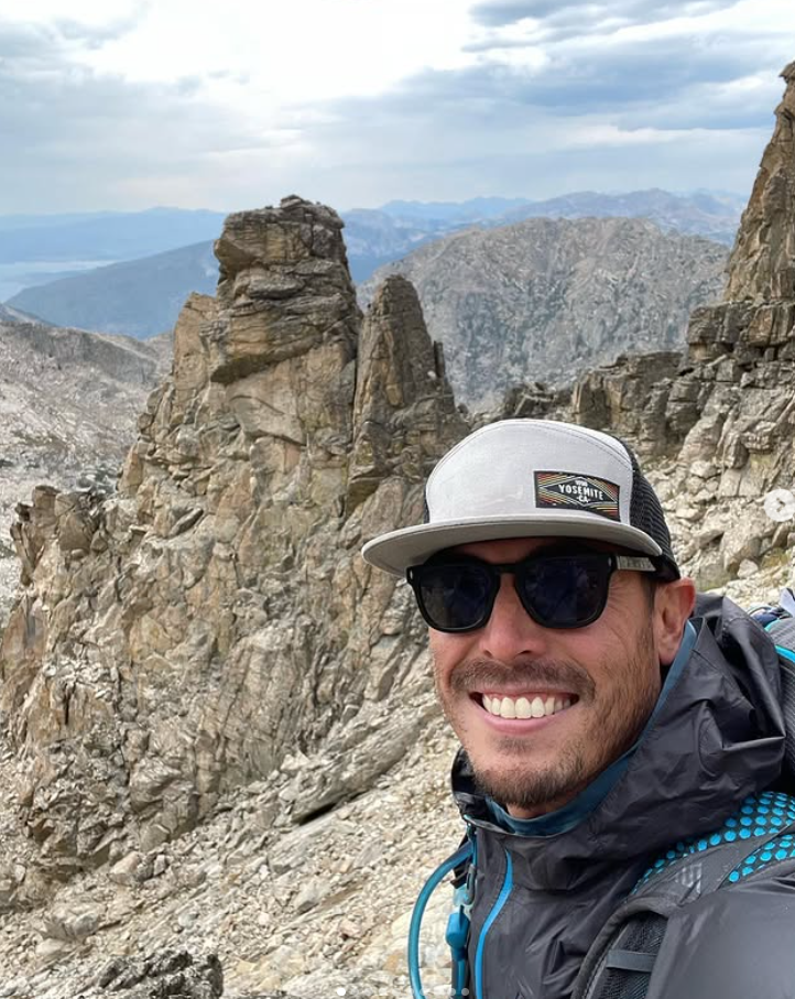
Cap Puckhaber
Backpacker, Marketer, Investor, Blogger, Husband, Dog-Dad, Golfer, Snowboarder
Cap Puckhaber is a marketing strategist, finance writer, and outdoor enthusiast from Reno, Nevada.
He writes across CapPuckhaber.com, TheHikingAdventures.com, SimpleFinanceBlog.com, and BlackDiamondMarketingSolutions.com.
Follow him for honest, real-world advice backed by 20+ years of experience.