
Backpacking the Cirque of the Towers Loop Counterclockwise in Three Days
By Cap Puckhaber, Reno, Nevada
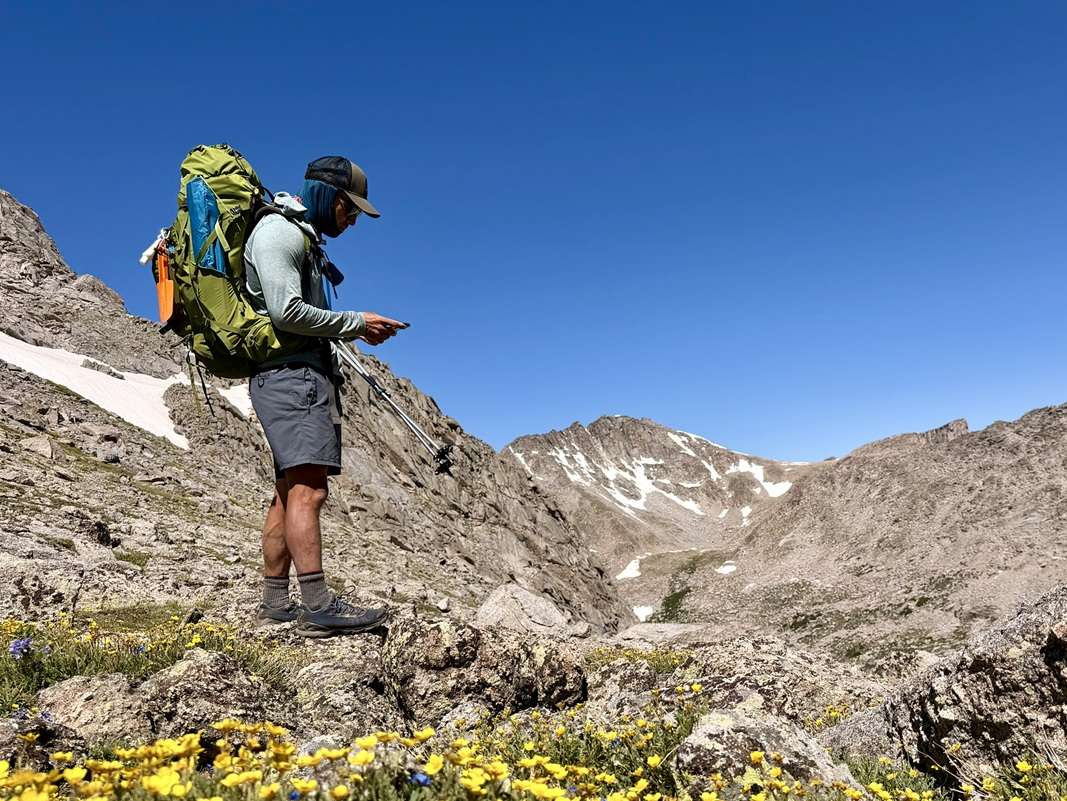
The Cirque of the Towers loop had been on my list for years. It sits deep in the Wind River Range of Wyoming, between the Bridger Wilderness and the Popo Agie Wilderness. The granite spires there look like something out of a postcard. My trip covered roughly 24 miles across three days and two nights. We started and ended at the Big Sandy Trailhead.
I want to walk through exactly how the trip went. That includes what I got right, what I got wrong, and the gear changes I’m already planning next. So much of this loop depends on timing and direction. Because of that, I’m going to get specific rather than generic. I’ll cover the drive from Salt Lake City, a night at a lodge with no electricity, a mosquito swarm that taught me a hard lesson, and the two passes that make up the physical core of the trip.
Why I chose this loop over other Wind River routes
I’ve hiked plenty of loops in the Wind Rivers. The Cirque of the Towers still keeps its reputation for a reason. Granite walls belonging to Pingora, Warbonnet, and Wolf’s Head rise straight out of a closed off basin. A 24 mile loop over three days works well for backpackers with some altitude experience. It also avoids the 40 plus mile version some hikers add by connecting to Grave Lake or Skull Lake.
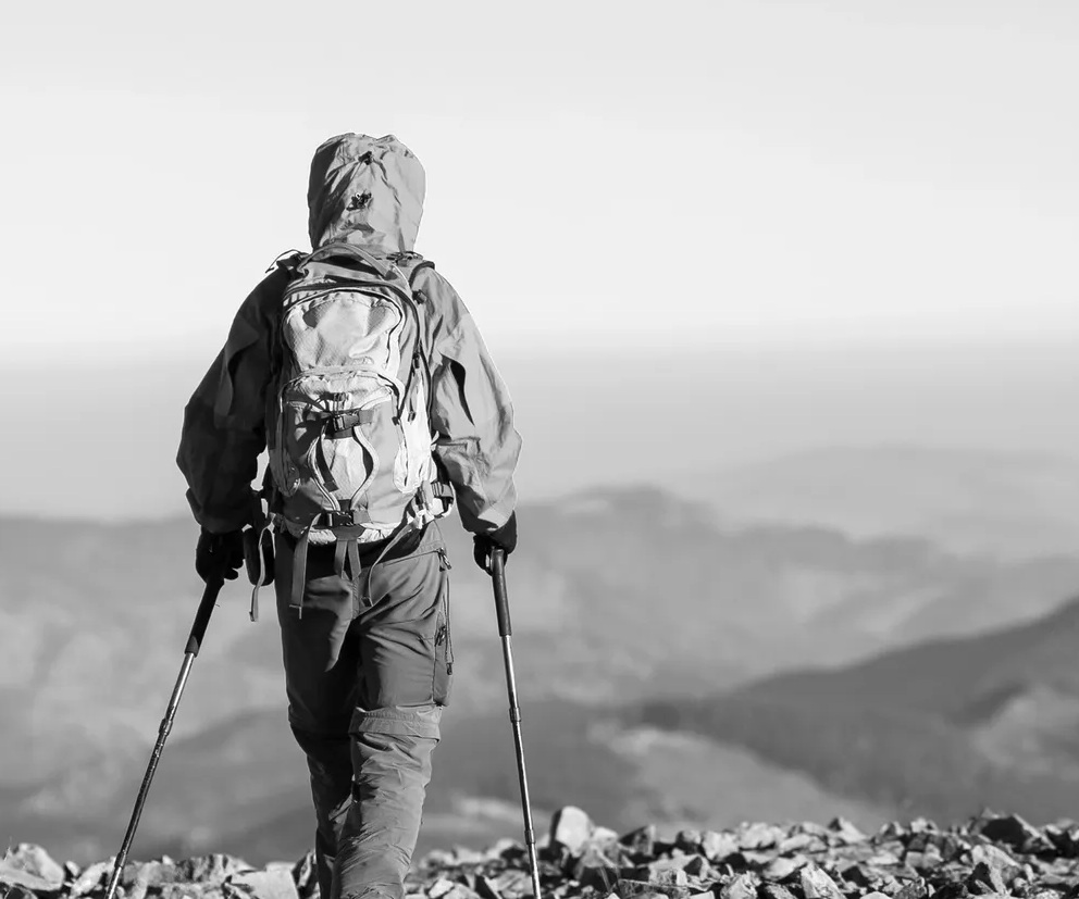
Total elevation gain and loss on this route lands somewhere around 5,000 feet across the three days. That’s a real number, but it’s manageable when it’s spread across two big passes instead of stacked into one brutal climb. Trekking poles helped a lot on the descents, especially with a loaded pack pressing down through the knees. I’d call them close to essential rather than optional gear on this particular loop.
I wanted a trip that let me sit with the scenery instead of rushing past it. So I kept the mileage modest. The basin sits about ten miles from the trailhead, so you earn the views with real mileage first. I’ve done longer loops in this range before, adding on Grave Lake and Skull Lake. That version has its own appeal, but it trades intimacy with the cirque for extra distance. This time I wanted the cirque itself to be the focus, not a waypoint on a bigger circuit.
Timing the trip around snowpack
The Wind River Range holds snow late into the season. Timing this trip matters more than most people expect. Most guides point to July through September as the safe window. That range shifts depending on the previous winter’s snowfall, though. Since we went early in the summer, we still found standing water and lingering snowfields.
Creek crossings ran high throughout the basin. That timing gave us dramatic scenery and fewer crowds. It also set up the mosquito problem I’ll get into later. If you’re picking dates months out, call the Pinedale Ranger District close to your trip date. Ask about current snowpack before you commit to a specific week.
Getting to the trailhead from Salt Lake City
We flew into Salt Lake City, rented a car, and drove five hours to Big Sandy Lodge. That routing wasn’t random. Our flight from Reno to Jackson Hole would have connected through Salt Lake City anyway. So flying in and driving saved us a leg. It also gave us more control over timing. The freeway portion of the drive was easy. Once we turned toward Farson, the trip changed character fast.
The whole drive covers close to 200 miles from Salt Lake City. That distance sounds long, but the freeway stretch through Utah and into Wyoming moves fast, since the speed limit runs 80 miles an hour for most of it. It’s the last two hours that slow everything down. Plan for the drive to take a full five hours door to door, and build in extra time if you’re arriving close to dark.
Farson is your last stop for gas and supplies
Farson is the last town with gas and real supplies before Big Sandy. Stock up there. There’s a gas station and a small general store. Once you leave, you won’t see another one until you’re back. Past Farson, the road turns to dirt for roughly two hours. It was rougher than I expected in a rental sedan.
My Tacoma would have handled it without a second thought. The compact rental struggled with the washboard sections and a few larger ruts. We crawled through some stretches at fifteen miles an hour. That protected the tires and the suspension. If you’re flying in and renting a car, ask for something with real clearance. It’ll save you a slow, bouncy drive and a lot of stress.
A night at Big Sandy Lodge before the trail
We stayed at Big Sandy Lodge the night before we hiked in. It turned out to be one of my favorite parts of the whole trip. The lodge doesn’t have electricity, but it does have hot showers. It also serves a hot, home cooked meal, which felt like a real luxury given how remote it is. Sitting at 9,100 feet at the edge of the Bridger Wilderness, it’s the closest access point to the Cirque of the Towers.
We ate dinner family style with other hikers headed into the same basin. That conversation gave us a good sense of trail conditions before we even started walking. Starting a backpacking trip with a real meal and a real bed made the next morning much easier. Cell service disappears well before you reach the lodge. It’s your last chance to message anyone before a few days off the grid.
Counterclockwise versus clockwise, and why I’d pick counterclockwise again
Most hikers run this loop clockwise. We went counterclockwise instead, and I’d make that call again. Going clockwise means climbing the backside of Texas Pass, which is loose rock the entire way up. The counterclockwise direction climbs the front side of Texas Pass instead.
That side is more gradual marble, with patches of snow depending on the season. Loose scree under a loaded pack is one of my least favorite things on trail. Because of that, the smoother ascent made a real difference on day two. I didn’t find the clockwise direction significantly harder overall. But I’d rather earn the views on stable footing than on ball bearings disguised as rock.
Camping rules in the Bridger and Popo Agie Wilderness
No permit is required for groups under fifteen people. Both the Bridger Wilderness and the Popo Agie Wilderness allow dispersed camping without a permitting system. That freedom comes with a few real rules worth knowing. You need to camp at least 200 feet from any lake, trail, or wet meadow. Stay at least 100 feet from any stream or creek.
The Cirque itself carries a stricter rule. Camping is prohibited within a quarter mile of Lonesome Lake to protect the fragile ground around it. Rules shift slightly once you cross into the Shoshone side of the Popo Agie Wilderness. It’s worth reading current forest service guidance before you set up your first camp.
Day one, Big Sandy Trailhead to the marsh below Lonesome Lake
We started at the Big Sandy Trailhead and hiked toward Lonesome Lake. A waterfall just short of the lake became our stopping point once we ran out of energy. Pushing the extra distance would have been nice. But we were tired enough that stopping made more sense than forcing it. The trail winds through forest and open meadow, gaining elevation gradually. That makes it a solid warm up day.
Early on, we crossed the Big Sandy River and passed a junction toward Meeks Lake that we skipped. Pine cover gave way to wider grassland as we settled into a steady rhythm. Since it was early summer, there was still standing water and patches of snow scattered through the basin. That set up the next problem before we even noticed it. Our packs still felt heavy at this point, since we hadn’t burned through any food weight yet. The gradual climb gave us a fair test of how the fit was going to hold up over the miles ahead.
The mosquito lesson I won’t repeat
The marshy ground just below Lonesome Lake turned into a mosquito breeding ground. It was the worst insect pressure I’ve ever dealt with on trail. Standing water and snowmelt that early in the season create exactly the conditions mosquitoes want. We were parked right in the middle of it.
I had brought natural eucalyptus oil as my repellent, thinking it would be gentler and still effective. It did nothing. I’ll never rely on it again for a trip like this. Next time I’m going straight to DEET based repellent or a picaridin repellent. Both actually hold up against early season swarms.
Day two, Jackass Pass, Texas Pass, and the heart of the cirque
Day two started with roughly 1,000 feet of vertical gain up Jackass Pass. Another 1,000 feet followed up Texas Pass. From there we descended the backside of Texas, since we were moving counterclockwise. This was the physical crux of the trip. It’s also where the scenery stopped being good and started being genuinely stunning.
Jackass Pass tops out with a sign marking the edge of the Popo Agie Wilderness. It’s worth pausing there, since the best angle on the whole cirque sits just off the main trail. Crossing two passes in one day with a loaded pack asks a lot of your legs. So we kept a steady pace and took breaks at the top of each climb. We wanted to actually look around instead of just pushing through. Lunch happened at the saddle of Texas Pass, with Lonesome Lake spread out below us. It remains one of the best trail lunches I’ve had anywhere.
The peaks that make the cirque famous
Along the way we picked out the peaks that give the Cirque of the Towers its reputation. Lizard Head, Warbonnet, Pingora, Skunk Knob, and Wolf’s Head all ring the basin. Each one carries a distinct silhouette against the sky. Pingora draws most of the technical climbers. But from the trail it’s just as striking as a backdrop. Because the whole basin is compact, you get close, unobstructed views of nearly every major spire without needing binoculars.
Pushing on to Marms Lake
We needed to make up mileage we’d lost by stopping short of Lonesome Lake on day one. So we pushed all the way to Marms Lake and camped there for the second night. We found a decent spot right on the lake. It was still buggy, but nowhere near as bad as the marsh below Lonesome. Camping at Marms Lake also broke up the final day nicely. It left a shorter, more relaxed hike back to the trailhead.
Water sources and picking a campsite
Water was never a concern on this loop. The basin is fed by snowmelt and holds lakes and streams at nearly every mile. Day one gave us the Big Sandy River as our source. Small tributaries near Jackass Pass and Marms Lake itself covered us for the rest of the trip. Because so much of the water was still running high with snowmelt, it stayed clear and cold at every source we used.
Finding a legal campsite took a little more planning than the water did. The 200 foot rule from lakes, plus the quarter mile buffer around Lonesome Lake, rules out a lot of the obvious flat spots. We scouted each site a few minutes before committing. Level ground, a wind break, and enough distance from the shoreline were the three things we looked for every time. Both nights we set up before the wind picked up, which made staking out the tent a lot easier. Afternoon gusts are common in this basin, so morning and early evening tend to be the calmest windows for pitching camp.
Day three, hiking back to the trailhead
The final day was straightforward. We hiked back out to the Big Sandy Trailhead, retracing familiar ground. Since we didn’t have any climbing left to do, we took our time and let the miles pass slowly. Overall, I’d call this loop moderate rather than difficult.
The elevation gain is real, but it’s spread out enough across three days. It doesn’t overwhelm anyone with decent fitness and some backpacking experience. Peaks, alpine lakes, and open meadows trade off at every turn. The scenery carries the trip from start to finish.
Wildlife, stars, and the quiet of the Wind Rivers
We didn’t see a ton of wildlife. That’s probably because this loop sees enough foot traffic to push animals farther out. Still, we spotted a deer and a marmot. We also heard an elk bugle at around two in the morning that echoed through the whole basin. That bugle carried for what felt like a full minute across the granite walls. It was loud enough to wake both of us out of a dead sleep.
The real payoff came after dark, though. With zero light pollution out there, the entire Milky Way was visible, along with the Big Dipper and several shooting stars. We laid outside the tent on our sleeping pads for close to an hour, just watching the sky. Neither of us wanted to be the one to say it was time to go back inside. If you’ve never watched a night sky like that, it’s worth the trip on its own.
How this compares to Asgard Pass in the Enchantments
People who’ve done both loops always ask how this compares to the Enchantments in Washington. So I’ll answer it directly. Texas Pass and Jackass Pass are real climbs. But neither comes close to the punishment of Asgard Pass in the Enchantments. Asgard gains roughly 2,200 feet in under a mile of loose talus. It stays relentless the entire way up.
The Cirque of the Towers spreads its elevation gain over more distance and gives you better footing, especially counterclockwise. Our combined climb over both passes added up to about 2,000 feet spread across several miles. That’s a completely different experience than gaining the same elevation in under a mile of unstable rock. If you’ve survived Asgard Pass, this loop will feel manageable. You’ll likely find yourself enjoying the climbs instead of gritting your teeth through them. A hiker without that experience will still find this a gentler introduction to Rocky Mountain passes. It’s a good way to build confidence before tackling something steeper.
What I’m changing for my next trip to Ansel Adams Wilderness
I tried to keep my pack light on this trip, aiming for 30 pounds. Carrying more than planned ended up being the reality. Group gear made up a big share of that, since I hauled a two person tent shared with my wife, plus the stove, fuel, water filter, and first aid kit. A deck of playing cards that never left my bag was one of the things I really didn’t need. My camping chair and my Teva flip flops did stay behind. That helped, but not enough to hit my target weight.
For my next trip into the Ansel Adams Wilderness, I want to actually land at 30 pounds. I’m switching to a thinner sleeping pad. That costs me some R value and some comfort, but it saves real weight. Snack quantity is getting cut down to what I’ll actually eat.
The puffy coat stays home since the forecast doesn’t justify it. I’m also swapping the shared two person tent for my one man tent. None of these changes are dramatic on their own. Together, though, they should get my pack close to where I want it.
What actually stays in my pack
Some of the weight I carried on this trip was never up for debate. The shared tent, the stove and fuel, the water filter, and the first aid kit all serve the group. That job usually falls on me. Those four items alone add up fast. But they’re the difference between a comfortable trip and a miserable one if the weather turns.
What I’m actually cutting is the extra layer of comfort items stacked on top of the essentials. The playing cards, the camp chair, and the flip flops were nice to have in theory. But none of them earned their weight on a three day trip. Going forward, I’m holding myself to a simple test before anything goes in the pack. If I didn’t reach for it once on this trip, it doesn’t make the cut next time.
Frequently asked questions
How long is the Cirque of the Towers loop?
My route covered roughly 24 miles over three days and two nights. We started and ended at the Big Sandy Trailhead. Some hikers extend the loop past 40 miles by adding Grave Lake or Skull Lake. I kept mine shorter so we had time to actually enjoy the basin instead of rushing through it.
Should I hike the loop clockwise or counterclockwise?
I recommend counterclockwise, mainly because it puts you on the more gradual front side of Texas Pass instead of the loose backside. Clockwise isn’t dramatically harder, so either direction works if your group has a preference. But if loose scree bothers you under a loaded pack, counterclockwise is the more comfortable choice.
What’s the best insect repellent for early summer trips in the Wind Rivers?
Skip natural oils like eucalyptus. I found mine completely ineffective against the mosquito swarms below Lonesome Lake. A DEET based repellent or a picaridin repellent will actually hold up against snowmelt season bugs. Pack more than you think you’ll need if you’re hiking before mid-summer, when standing water is still widespread.
Do I need a permit to backpack the Cirque of the Towers?
No permit is required for backpacking groups under 15 people in either the Bridger Wilderness or the Popo Agie Wilderness. You do need to follow dispersed camping rules, including staying at least a quarter mile from Lonesome Lake itself. Check current regulations before you go, since backcountry rules can shift season to season.
Where should I stay the night before starting the hike?
I stayed at Big Sandy Lodge and would do it again without hesitation. It has no electricity, but it does have hot showers and a hot meal. That made the early trailhead start much easier the next morning. Booking ahead matters since the lodge is remote and rooms fill up during peak season.
How difficult is this loop compared to other Wind River routes?
I’d call it moderate rather than difficult, especially spread across three days. The two passes on day two are the physical crux of the trip. But the elevation gain is manageable for anyone with reasonable fitness and prior backpacking experience. It’s far less punishing than Asgard Pass in the Washington Enchantments, which stays steep and loose for its entire climb.
What’s a reasonable pack weight target for this loop?
I aimed for 30 pounds and came in heavier because I carried shared group gear like the tent, stove, and water filter. A three day, two night trip in this terrain is achievable closer to 25 or 30 pounds. You just have to be intentional about cutting comfort items you won’t actually use. Focus first on your heaviest three items, since your sleep system, shelter, and food typically account for most of the total weight on a trip this length.
Cap Puckhaber has spent years chasing loops like this one across the Rockies. Trips into the Wind Rivers tend to stick in memory longer than most, and this one was no exception. The Cirque of the Towers earned a permanent spot on the short list of favorites.
My Picks for Zion National Park Hikes
Grand Canyon Guide to Closures and Trails
Hiking and Backpacking Yellowstone
Check out news on new national park fees
Follow Cap Puckhaber on Social Media
- Connect with Cap Puckhaber on Facebook
- See Cap Puckhaber’s latest adventures on Instagram
- Read Cap Puckhaber’s thoughts on X
- Join the conversation on Threads
- Follow Cap Puckhaber on Mastodon
- Browse my Pins on Pinterest
- See my Hiking Articles on Medium
- Follow Cap Puckhaber’s Company Page on LinkedIn
- More Hiking and Snowboarding on BSKY


About the Author: Cap Puckhaber
Backpacker, Marketer, Investor, Blogger, Husband, Dog-Dad, Golfer, Snowboarder
Cap Puckhaber is a marketing strategist, finance writer, and outdoor enthusiast from Reno, Nevada. He writes across CapPuckhaber.com, TheHikingAdventures.com, SimpleFinanceBlog.com, and BlackDiamondMarketingSolutions.com.
Follow him for honest, real-world advice backed by 20+ years of experience.